Slow days in the Gschnitz valley, under the Tribulaun peaks
Geraniums on every balcony, cowbells in the meadows and a yellow signpost pointing to a hut below the Tribulaun: a quiet Tyrolean valley right on South Tyrol's doorstep.
· 4 min read
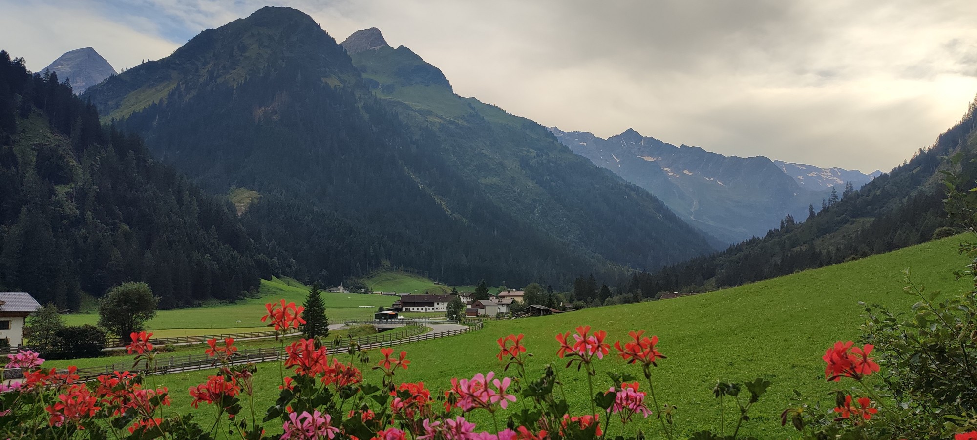
I almost didn't find the Gschnitz valley. Like most people driving the Brenner road between Innsbruck and Italy, I had always kept my eyes on the motorway and the border ahead. This time we turned off at Steinach am Brenner, followed a narrow road west past the village of Trins, and within twenty minutes the traffic noise was gone. What was left was a green, steep-sided valley, a handful of farmhouses, a river and, at the far end, a wall of grey peaks with the last patches of summer snow on them.
We stayed a few days in the upper part of the valley, around Untertal and Obertal, and it turned out to be exactly the kind of place I had been looking for: no big resort, no queues, just meadows, forest and mountains, and a lot of time to enjoy them.
Mornings on the balcony
Every house in the valley seems to have the same thing: a wooden balcony overflowing with red and pink geraniums. Ours did too, and that balcony became my favourite place. I would make a coffee, step outside before anyone else was up and just watch the light move over the valley. The meadows below are cut for hay several times a summer, so they look almost like a lawn, and the sound of cowbells drifts up from somewhere you can never quite see.
The weather in a valley like this changes by the hour. Some mornings started grey and heavy, with cloud sitting on the summits, and an hour later the sun was out and the whole slope was glowing green. Don't let a gloomy start put you off; just wait a little.
The walk to the Tribulaunhütte
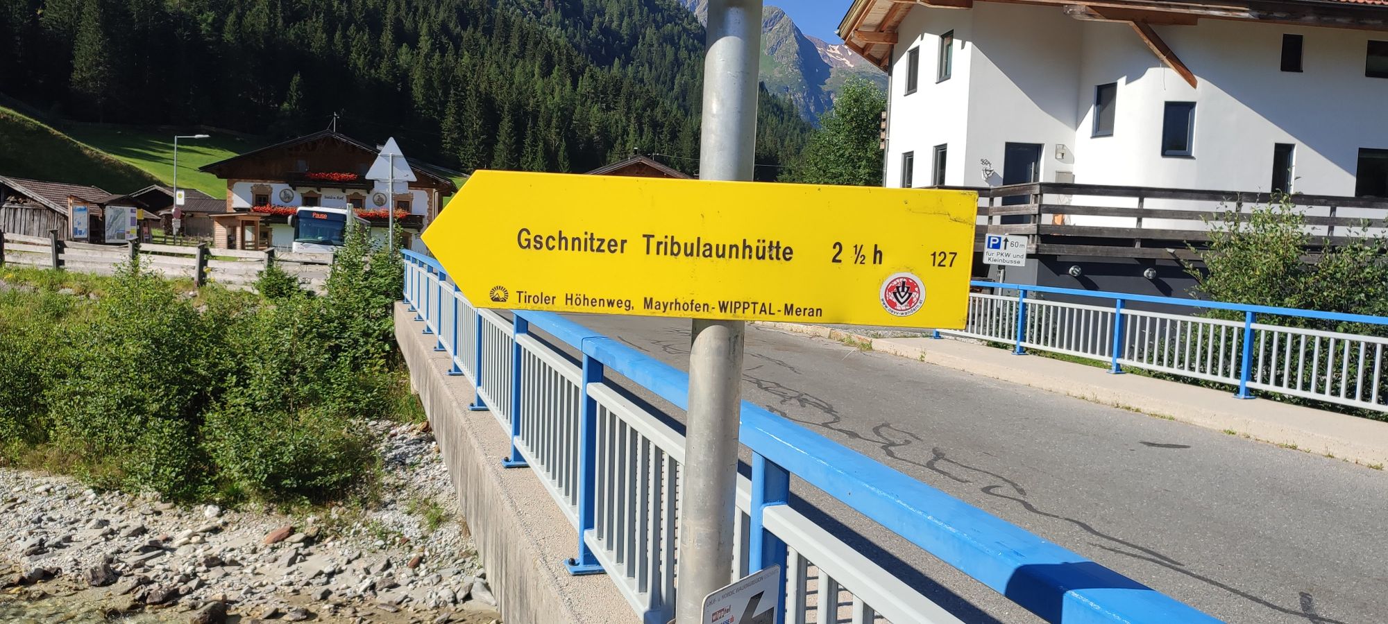
The trail sign on the bridge in Gschnitz: Tribulaunhütte, two and a half hours, path 127.
Austrian trail signs are wonderfully honest. The yellow arrow on the bridge in Gschnitz says the Gschnitzer Tribulaunhütte is two and a half hours away on path 127, and that is about right if you walk steadily without too many photo stops. I needed a bit longer.
The path climbs south out of the valley, first through forest and then over open slopes, to the hut at a little over 2,000 metres. It sits right below the Tribulaun group, a cluster of pale, jagged limestone peaks that look almost Dolomite-like and form the border with Italy. On the other side of that ridge is the Pflerschtal in South Tyrol, which is why this corner feels so connected to both countries. The sign itself gives a hint too: this path is part of the Tiroler Höhenweg, a long-distance route from Mayrhofen over the Wipptal to Meran.
It is a proper mountain walk, steep in places, so good shoes and some fitness help. But you don't have to be a climber, and a cold drink on the hut's terrace with the Tribulaun towering above makes every step worth it.
Quiet corners of the valley
The rest of our days were slower. A few things I would recommend:
- The pilgrimage church of St. Magdalena. A small church high on the slope above Gschnitz, reached on a steep forest path. The view back over the valley is beautiful, and you will probably have it to yourself.
- Just walking the valley floor. A gentle path follows the river and the meadows, perfect for an evening stroll when the peaks turn pink.
You may read about two other sights here: the old mill village and the Sandes waterfall. Sadly, mudslides at the end of June 2025 almost completely destroyed the mill village, and the waterfall path has been closed since. Check with the local tourist office whether either has reopened before you plan around them.
A small fact I enjoyed: geologists named a stage of the last ice age after this valley, the Gschnitz stadial, because of the moraines the glaciers left behind here. Once you know that, you start seeing the valley's shape differently.
A room with this view
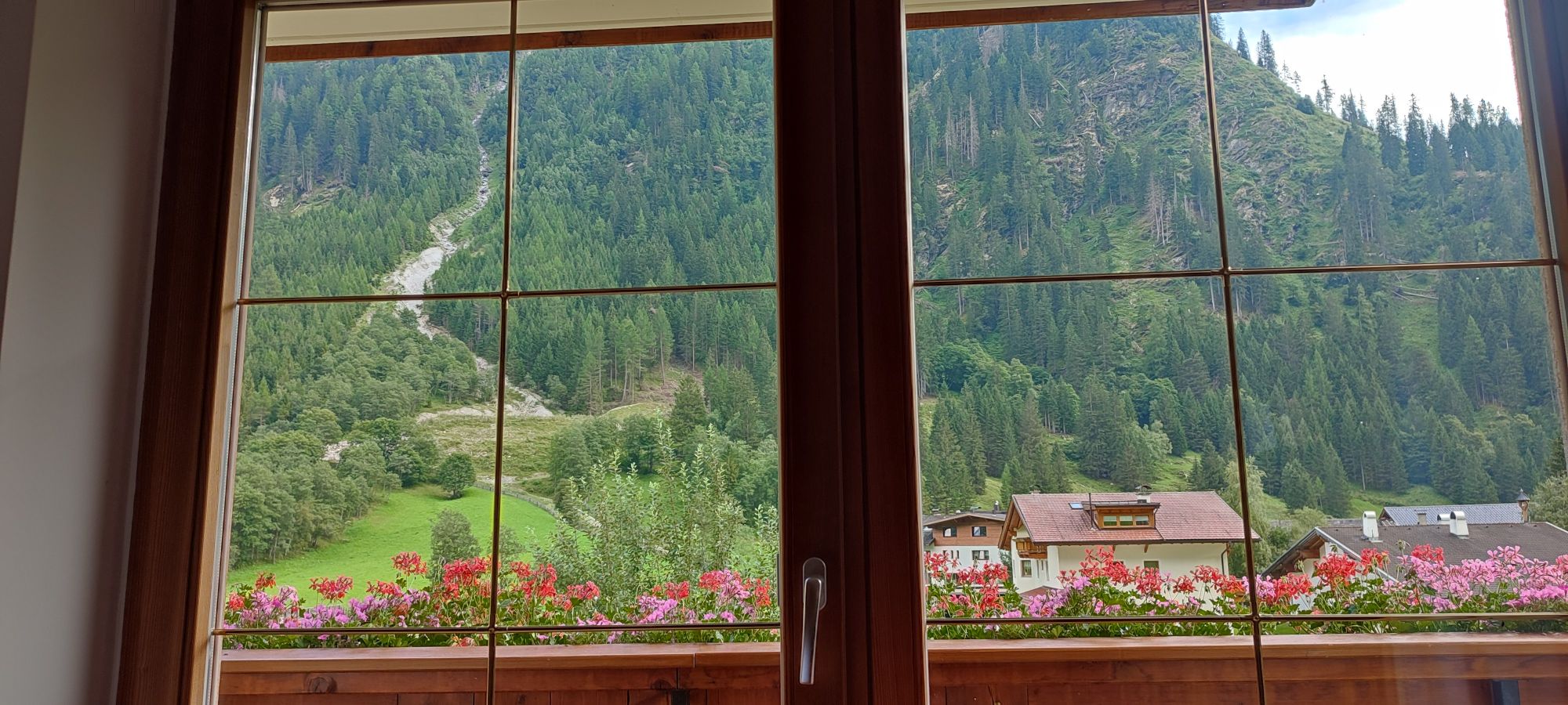
Even on a rainy afternoon, the view from the window was hard to beat.
On the one properly rainy afternoon, I sat by the window in our room and didn't mind at all. Across the valley, a stream had carved a pale scar of rock and gravel down through the dark forest, the neighbours' balconies were full of flowers, and the clouds kept lifting and falling over the slope. It sounds like nothing, but it is one of my strongest memories of the trip.
Before you go
- Getting there. Leave the Brenner road or the motorway at Steinach am Brenner and follow the signs to Trins and Gschnitz. Regional buses run up the valley from Steinach, which has a train station on the Innsbruck–Brenner line.
- When to come. Summer and early autumn are best for hiking, when the huts are open. Check the hut's season before you set out.
- Pack for every weather. Even in August, mornings are cool and afternoon showers are common.
- Stay a few nights. The valley is close enough to Innsbruck for a day trip, but its real charm is in the quiet mornings and evenings, after the day visitors have gone.
If you are on your way to South Tyrol, or just want a few days of Tyrol without the crowds, take that turn at Steinach. I'm glad I finally did.